

Tutorial: How to Use the Pennsylvania Mine Map Atlas
Section 4: Connecting to Phummis
PHUMMIS is the Pennsylvania Historic Underground Mine Map Inventory System. This database, which is hosted by the Pennsylvania Department of Environmental Protection contains information relevant to past and present underground mining within the Commonwealth of Pennsylvania, including, but not limited to, maps, indices, locations of mines, and other pertinent data contained in various collections held or obtained by the Pennsylvania Department of Environmental Protections (Department) Office of Active and Abandoned Mine Operations. PHUMMIS and the Pennsylvania Mine Map Atlas are integrated to allow users to access both the mine maps and information from the PHUMMIS database.
Connecting to PHUMMIS from the PA Mine Map Atlas
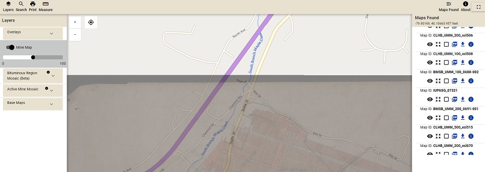
Once you have found the mine map you want more information for, you can easily connect to the PHUMMIS database from the PA Mine Map Atlas. To do so, simply click on the Information Button in the Mine Maps Found Side Bar.
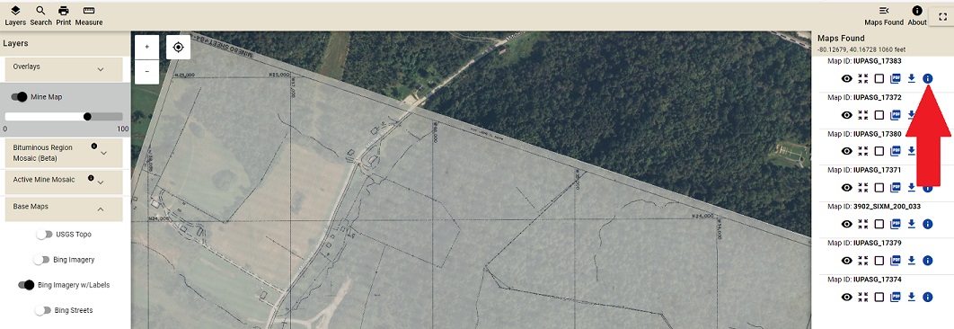
This will take you to PHUMMIS, where you can find more information about your map. Mine Name, Company Name, Sheet Name, Local Sheet ID, and Map Type are among the information you will find on PHUMMIS.
Other information included in the description include: Mines, General, Location, Geology, and Scanning.
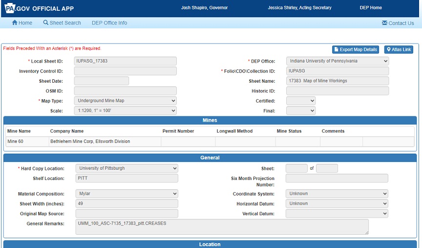
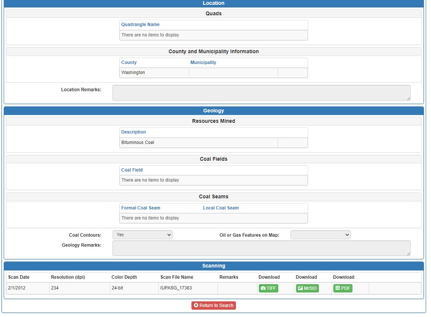
Each physical map in the Pennsylvania Mine Map Repository has a record in the Pennsylvania Historic Underground Mine Map Inventory System (PHUMMIS) database, referred to as a Sheet. The top of each Sheet Record list identification information about the sheet, the type of map it is, map scale, and the organization that processed it. The Mines section lists the mines and their operators that are shown on the map. The General section provides information about the physical map and where it is stored. The Location section provides information about where is Pennsylvania the mine shown on the map is located. The Geology section provides information on the coal seam that mined. The Scanning section provides links to download digital copies of the map in a variety of formats
Downloading and Viewing the Mine Maps via PHUMMIS
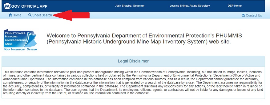
You may download the digital mine maps that are available through the PA Mine Map Atlas or via the PHUMMIS interface. You may also start your initial search through PHUMMIS.
Please Note the PHUMMIS Legal Disclaimer.
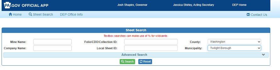
The PHUMMIS search interface allows users to search for mine maps using very specific criteria. Search by Mine Name, Company Name, Folio\CDO\Collection ID, Local Sheet ID, County, Municipality. (SEE EXAMPLE BELOW).
There is no fuzzy search, your search has to be an exact text match. A Percent Sign (%) can be used for wild card searches.
An Advanced Search is also available
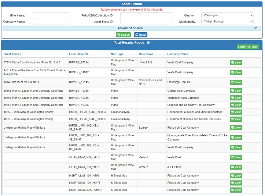
Click the Green View Button to access the information page for your map.
At the bottom of your information page will be links to download your map
choose from TIFF, SID, or PDF formats.
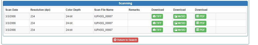
NOTE: Not all mine maps are currently available for downloading. New maps are added every month to the PA Mine Map Atlas and PHUMMIS. If the map you are looking for is unavailable, you will be prompted to contact the DEP
If the map you are interested in is available, you will be prompted to save it after clicking on either Tiff,Sid,or PDF.
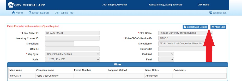
To generate a pdf report of your map Click Export Map Details in the upper right hand corner of View Details screen.
To view the map you are interested in via the PA Mine Map Atlas, click on Atlas Link in the upper right hand corner of the View Details screen. This will take you directly to the map so you can view it online via the PA Mine Map Atlas. NOTE: Please be sure that you do not have Pop Up Blockers on. The link to the PA Mine Map Atlas opens a new window.
To go back to Section 3, Advanced Tools, click the Back button below.
To return to the PA Mine Map Atlas, click the Continue button below.

